Overview
This tool enables emergency managers, community partners, and state agencies of all GIS skill levels to visualize and assess challenges to community resilience. It supports strategic decision-making for preparedness, mitigation, response, and recovery.
Resilience Analysis and Planning Tool Resource Center
Features
- Extends GIS capacity for state and local officials to better understand disaster impacts and potential resilience challenges
- Includes over 100 pre-loaded data layers covering population demographics, infrastructure, and hazards.
- Promotes data-driven decision-making by helping users examine the interplay between population characteristics, community and infrastructure data, hazards, weather, and risk
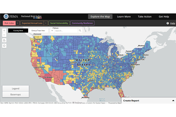
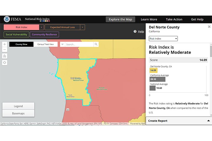
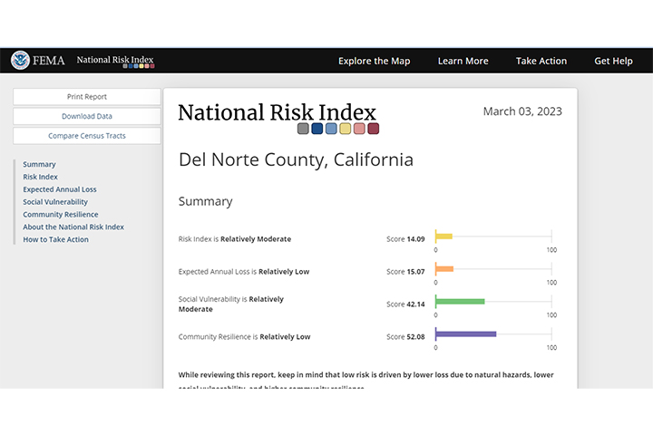
Tool Screenshots