Issue
The increasing demand for American-grown seafood and improved technology to farm in the open ocean provide opportunities for aquaculture development. NOAA identified areas containing locations suitable for commercial aquaculture to support this ocean industry and its potential to promote economic growth.
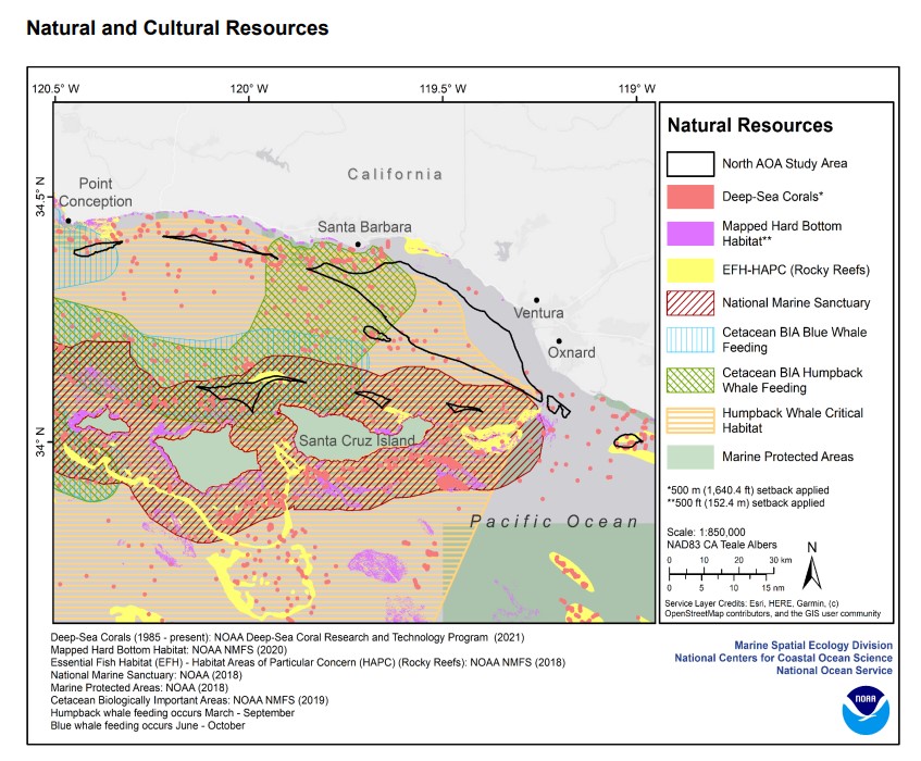
Process
For the first phase of identifying aquaculture opportunity areas, NOAA developed two marine spatial aquaculture atlases to identify areas that might be suitable in the Southern California Bight and the Gulf of America. The atlases were developed by NOAA’s National Centers for Coastal Ocean Science using best-available science and through extensive public engagement, and they provide the most comprehensive marine spatial analyses ever developed for any U.S. ocean space. Each atlas is based on spatial modeling using over 200 data layers that characterize the ocean neighborhoods, identifying many options in each region that may be highly suitable for aquaculture opportunity area development. Over a dozen datasets from MarineCadastre.gov were critical in this analysis, including oil and gas pipelines, wells, artificial reefs, submarine cables, and vessel traffic. The atlases also include web links to custom OceanReports for each area identified so that users can get the most current data during public comment periods.
Impact
The aquaculture opportunity area atlases for the Southern California Bight and the Gulf of America will be used by natural resource managers, industry, regulators, and coastal planners to better understand aquaculture opportunities in the U.S. Exclusive Economic Zone. Now that the atlases are released, the NOAA National Marine Fisheries Service will next gather public comment and coordinate discussions with regional and national stakeholders. The decision to formally establish an aquaculture opportunity area will only be made after completion of the National Environmental Policy Act process and consideration of the information presented in a programmatic environmental impact statement. (2022)